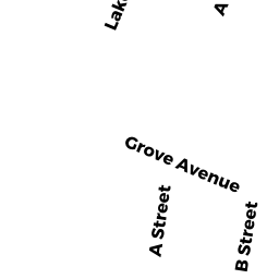
104 A ST
Owner Information
COGAN MICHAEL (TE)
104 A ST
DRACUT, MA 01826


Property Details
104 A ST is classified as a Single Family Residential (Colonial).
The primary structure on this property was built in 1997. There are 2,484ft2 of built area within this property. There is 1,470ft2 of residential/living space within this property. This property is listed as having 60 rooms.
104 A ST is valued at $318,200. The land is valued at $121,200 and the structures are valued at $194,600. There is an additional valuation of $2,400 on this property.
This property is in Zone R1. Confirm with local Zoning Board authorities to ensure there are no overlays or other easements on this property.
The most recent deed for 104 A ST is recorded at the local registrar in Book 18369, Page 0119. 104 A ST was last sold on Tuesday, February 1, 2005 for $1.
Assessment data from fiscal year 2022.
Flood Data
According to the FEMA National Flood Hazard Layer, this property does not appear to be in a flood zone. It may also be in an area not yet reviewed. Nonetheless, confirm this information prior to taking any action.
To view the flood hazards around this property, create a FEMA "Firmette" Map of the area around 104 A ST.
Broadband Internet Providers
| Provider | Type | Bandwidth (mbps) | |
|---|---|---|---|
| Comcast | Cable | 1000 | 35 |
| Verizon New England Inc. | DSL | 15 | 1 |
| Viasat Inc | Satellite | 100 | 3 |
| GCI Communication Corp. | Satellite | 0 | 0 |
| HughesNet | Satellite | 25 | 3 |
| VSAT Systems, LLC. | Satellite | 2 | 1 |
Broadband service provider data from December 2020.
Adjacent Properties
- 103 LAKESHORE DR
Single Family Residential owned by BONANNO NICHOLAS (TE) - 97 LAKESHORE DR
Single Family Residential owned by PYNN KEVIN T. (TE) - 98 A ST
Single Family Residential owned by PROVOST ALAN MICHAEL - 107 LAKESHORE DR
Single Family Residential owned by NOGLER RALPH O (TE) - 110 A ST
Single Family Residential owned by MELLO JEFFREY A. (JTRS)